In trajectory analysis, an air parcel is regarded as a mass point, and its moving path (trajectory) can be calculated using meteorological data. METEX (Meteorological Data Explorer), developed by the Center for Global Environmental Research (CGER), Earth System Division (ESD), National Institute for Environmental Studies (NIES), was used for this analysis.
Trajectory analysis can be utilized to estimate the pathway of air parcels to obtain information on the effect of high-concentration greenhouse gases or air pollutants to an observation point.
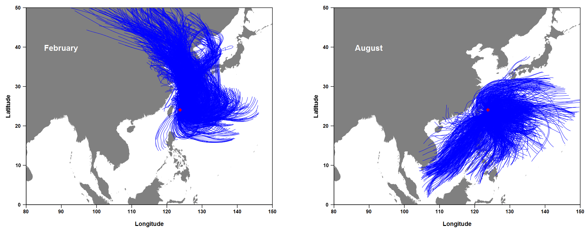
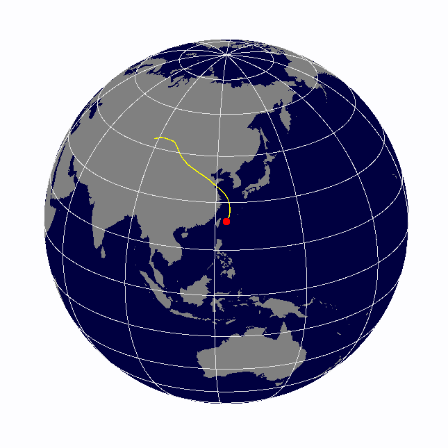
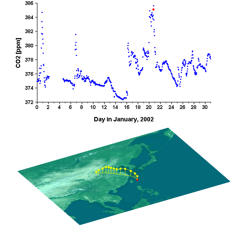
The following figure shows the trajectories passing over the Hateruma station in February and August of a certain year. An increase in CO2 concentration has been observed at Hateruma station from autumn to winter every year. In addition to the natural increase due to the decreasing uptake of terrestrial plant, enhanced spikes were often linked to air coming from China. By using this analysis, one can investigate the fluctuation of CO2 concentration in relation to economic activities.