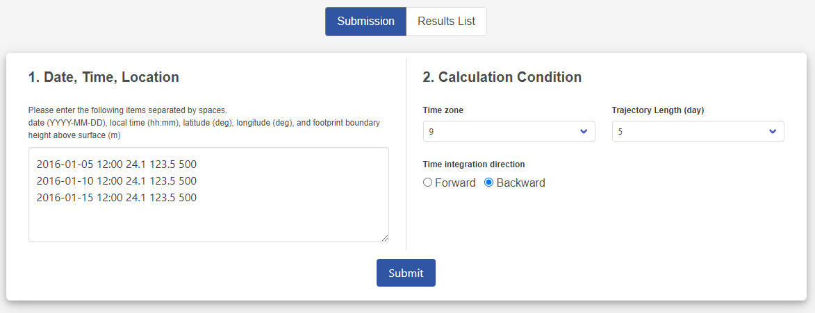
How to Use

Submission

You can calculate footprints at arbitrary times and locations by specifying initial times, locations (latitude, longitude) and height, trajectory length, and direction of time integration.
*User registration is required for submission.
Calculation User registration

You can manage your calculated results. The results can be projected on a map and downloaded in CSV format.

Calculation condition

Results List

The results of the footprint calculation are displayed on the "Results List".

List of calculation results

・Status

The processing status of the submission is displayed. Normally, the status changes from "Queue" to "Processing" and then to "Finished". An error message will appear in the progress status when a submission cannot be completed. If you do not understand the details of the error message, please contact us.
  • Submit

  • Queue

  • Processing

  • Finished

・Calculation condition

You can check the submitted calculation condition. "Mode" represents the direction of the time integration, where 1 means forward and -1 means backward.

・Result (CSV)

You can download the calculated results in CSV format. The footprint at a specified date and location is output as the mean residence time of Lagrangian particles in a 1°×1° grid cell.
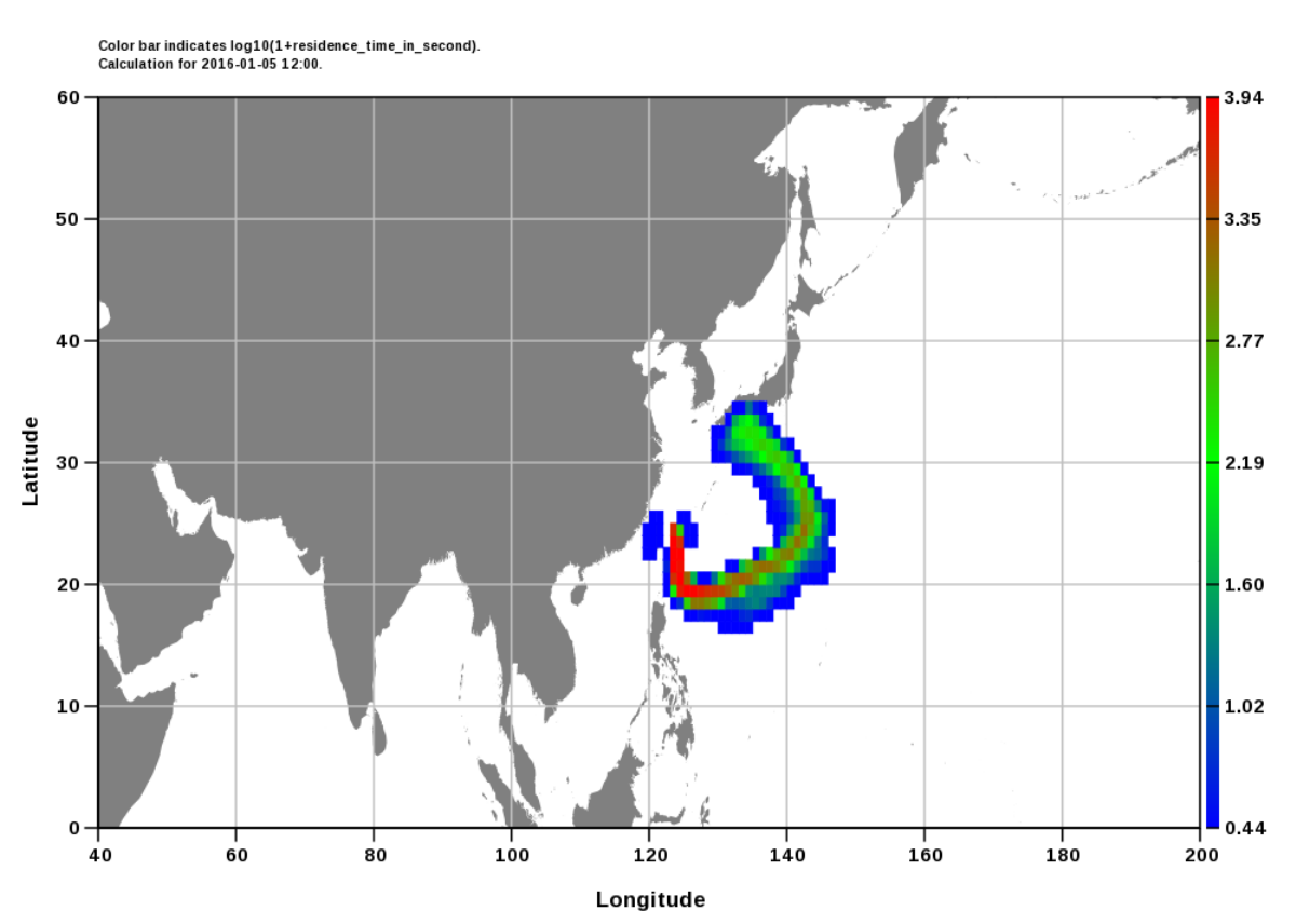
# log(1+residence_time_in_second) in 1x1 degree grid mesh
# left grid edge: 0 to 359 degree east
# bottom grid edge: -90 to 89 degree north
# submission: 2016-01-05 12:00 24.1 123.5 500
# time zone: 9 hour
# time length: 120 hour
......
0, 0, 0, 0, 0, 0, 0, 0, 0, 0, 0, 0, 0, 0, 0, 0, 0, 0, 0, 0, 0, 0, 0, 0, 0, 0, 0, 0, 0, 0, 0, 0, 0, 0, 0, 0, 0, 0, 0, 0, 0, 0, 0, 0, 0, 0, 0, 0, 0, 0, 0, 0, 0, 0, 0, 0, 0, 0, 0, 0, 0, 0, 0, 0, 0, 0, 0, 0, 0, 0, 0, 0, 0, 0, 0, 0, 0, 0, 0, 0, 0, 0, 0, 0, 0, 0, 0, 0, 0, 0, 0, 0, 0, 0, 0, 0, 0, 0, 0, 0, 0, 0, 0, 0, 0, 0, 0, 0, 0, 0, 0, 0, 0, 0, 0, 0, 0, 0, 0, 0, 0, 0, 0, 0, 0, 0.00641114591, 0.224317178, 0.565131724, 0.505406618, 0.193452165, 0.0971421301, 0.265902311, 0.4755117, 0.674931169, 0.743172288, 0.494648814, 0.135239422, 0.0011515154, 0, 0, 0, 0, 0, 0, 0, 0, 0, 0, 0, 0, 0, 0, 0, 0, 0, 0, 0, 0, 0, 0, 0, 0, 0, 0, 0, 0, 0, 0, 0, 0, 0, 0, 0, 0, 0, 0, 0, 0, 0, 0, 0, 0, 0, 0, 0, 0, 0, 0, 0, 0, 0, 0, 0, 0, 0, 0, 0, 0, 0, 0, 0, 0, 0, 0, 0, 0, 0, 0, 0, 0, 0, 0, 0, 0, 0, 0, 0, 0, 0, 0, 0, 0, 0, 0, 0, 0, 0, 0, 0, 0, 0, 0, 0, 0, 0, 0, 0, 0, 0, 0, 0, 0, 0, 0, 0, 0, 0, 0, 0, 0, 0, 0, 0, 0, 0, 0, 0, 0, 0, 0, 0, 0, 0, 0, 0, 0, 0, 0, 0, 0, 0, 0, 0, 0, 0, 0, 0, 0, 0, 0, 0, 0, 0, 0, 0, 0, 0, 0, 0, 0, 0, 0, 0, 0, 0, 0, 0, 0, 0, 0, 0, 0, 0, 0, 0, 0, 0, 0, 0, 0, 0, 0, 0, 0, 0, 0, 0, 0, 0, 0, 0, 0, 0, 0, 0, 0, 0, 0, 0, 0, 0, 0, 0, 0, 0, 0, 0, 0, 0, 0, 0, 0, 0, 0, 0, 0, 0, 0, 0, 0, 0, 0, 0, 0, 0, 0, 0, 0, 0, 0
......

・Map projection

The calculated footprint can be projected onto a spherical or plane map in the following two ways.

  1. Plot all results on a map
    Select "Plot all calculations in one graph".
  2. Plot one result on a map
    Select "Or plot a selected one only" and specify the number of calculated results to display. The first line of the submitted calculation condition is counted as one.

In the upper left corner of the map, the start date or the period of the footprints projected on the map is shown.

Map plot condition
Map plot

・Delete

You can delete the submitted job or delete the calculated result from the list.

Citation

Please cite this site when you publish the analysis results using this site. Also, please cite the meteorological data provided by NCEP.

Citation format

Global Environmental Database, Footprint (FLEXCPP), National Institute for Environmental Studies, Japan.
Accessed via https://db.cger.nies.go.jp/ged/flexcpp/en/index.html on YYYY-MM-DD