

Hateruma Station
Hateruma Island is Japan's southernmost inhabited island, located at about 60 km southwest of Ishigaki Island (center of the Yaeyama Islands) and about 60 km from the Tropic of Cancer.
The island has an area of approximately 12.8 km2, and a population of approximately 480 (as of March 2021), mainly engaged in sugarcane cultivation and brown sugar production.
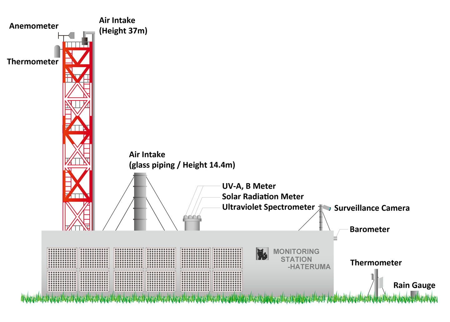
The monitoring station is located at the eastern end of the island, about 100 m inland from the coast where coral reefs have developed. The residential area, power plant, and sugar factory (which operates only during winter) are located on the west side of the island, and the observation air is sampled at a height of about 37 m on the observation tower, so there is almost no anthropogenic impact from island on observations during all seasons.
Station Exterior
| Location | Isehara 4793-2, Aza Hateruma, Taketomi, Yaeyama, Okinawa |
|---|---|
| Latitude | 24° 3′ 39″ N |
| Longitude | 123° 48′ 34″ E |
| Above sea level | approx. 10 m |
| Laying area | 566 m2 (government-owned forest borrowed) |
| Observation building construction | Single-story building made of reinforced concrete |
| Floor area | 160.7 m2 |
| Tower height | 38.0 m |
| Structure | Steel frame |
| Air intake height | 37.0 m |
| Completed | March 1992 (Observation started in Oct 1993) |
| Observation target | Baseline concentrations of GHGs and atmospheric trace substances in southern Japan |
| #GAW No. | GAW#HAT224N00 |
Layout of Hateruma Station
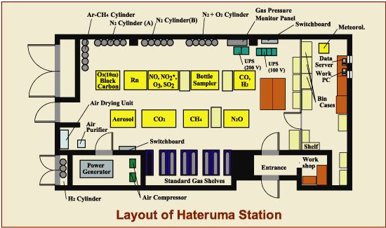
Photo Gallary
-
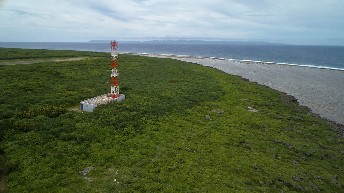 Drone Picture of
Hateruma Station -
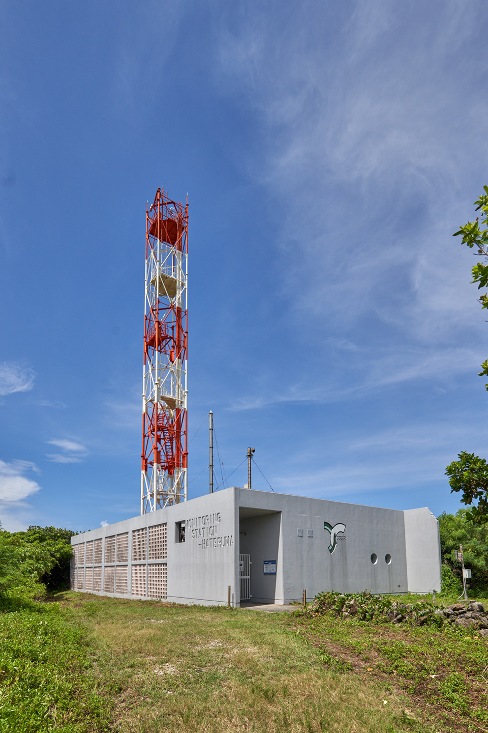 Station exterior
 -
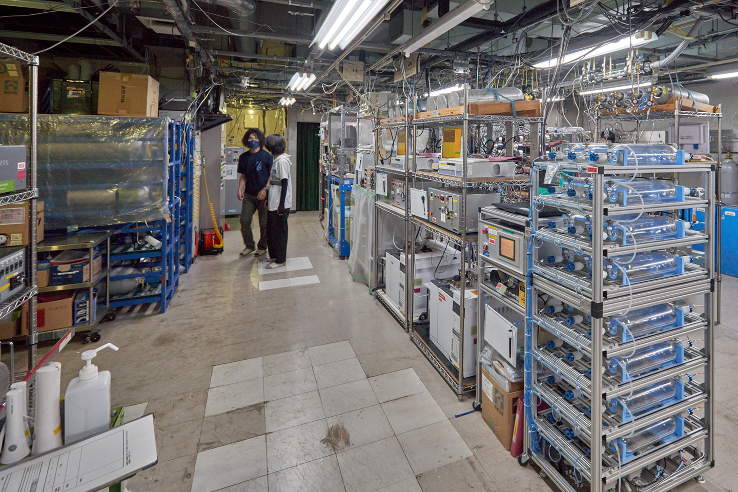 Station inside 1
 -
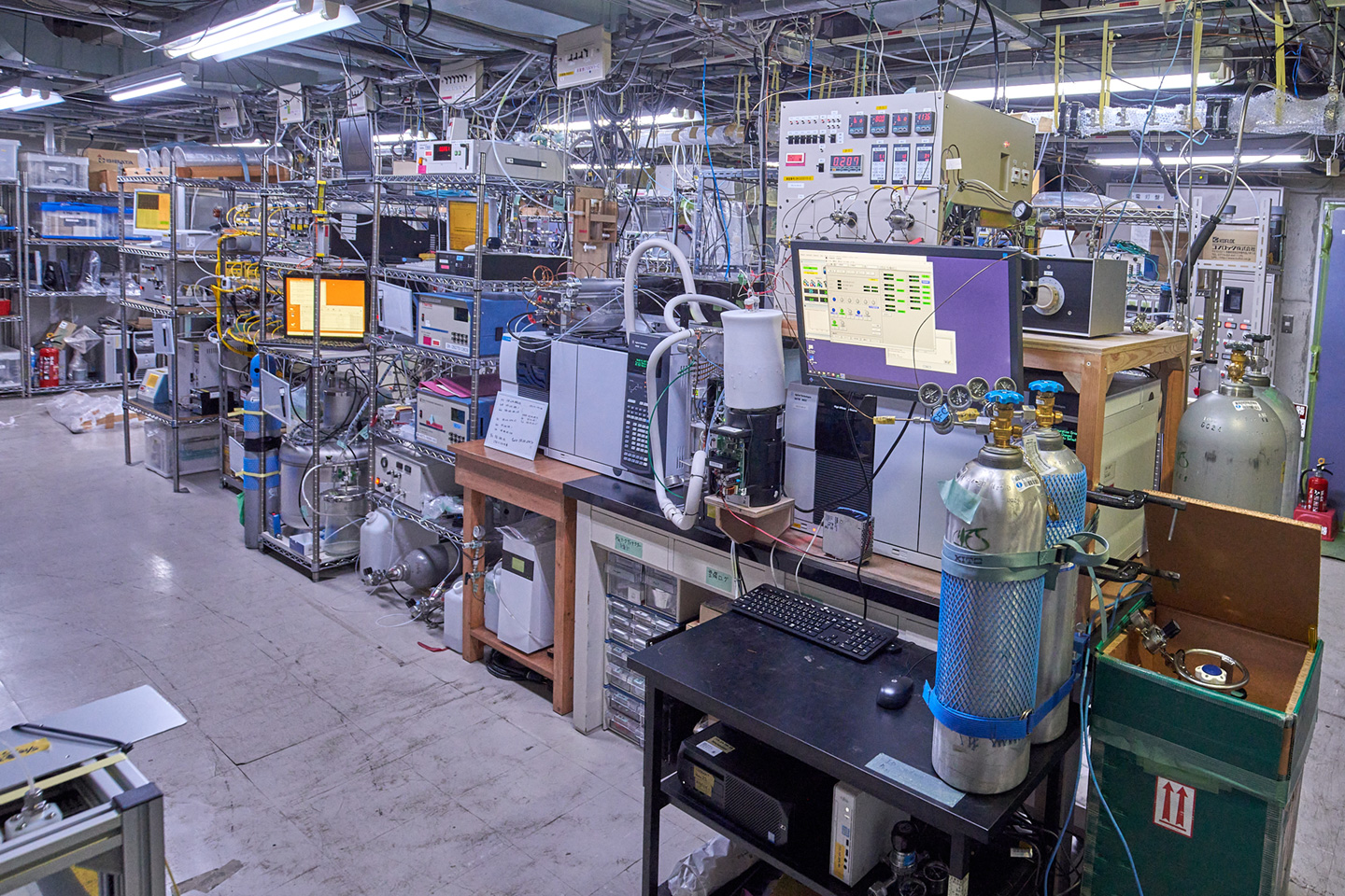 Station inside 2
(Click image for larger view)
Latest Observation Results
- CO2 Trend in Hateruma(Preliminary)